COMMUTERS faced chaos this morning with delays on road and rail and a crash on the M1 as forecasters warned of torrential rain and more flooding in parts of Britain already battered by Storm Angus.
Residents were sandbagging their homes near fast-rising rivers and the Environment Agency was preparing emergency flood defences as the country braced for heavy downpours of more than two inches – a fortnight’s worth – in just a few hours.
Millions of motorists heading to work were warned roads could be like lakes and emergency services are braced for a crop of crashes as drivers hit huge sheets of rainwater and lose control.
Shortly after 6am today police warned the A379 at the Countess Wear roundabout in Exeter is partly impassable because of floodwater.
Howling winds and driving rain led to speed restrictions and on the M48 Severn Bridge near Bristol this morning.
And a pile-up on the storm-lashed M1 involving a lorry, a van and a car has led to severe delays this morning on the northbound carriageway between junction 12 and 13 in Bedfordshire. It is not yet known if anyone was hurt.
Yesterday a pregnant woman and her one-year-old child had to be rescued by firefighters after their car got stuck in four feet of flood water in Mountnessing, Essex.
Essex Fire and Rescue Service said: “The control operator could hear the woman was extremely panicked and so kept talking to her to reassure her until crews arrived at the scene.”
As the Monday morning rush hour began, Great Western warned rail commuters of “severe delays” between Penzance and Exeter St Davids due to “poor rail conditions” caused by torrential rain and flooding between Par and Newton Abbot.
The South Coast was also hit – there are warnings of delays on the Hovertravel ferry service across the Solent this morning between Ryde and Southsea because of the bad weather.
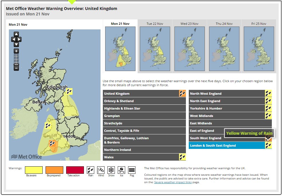
Five flood warnings and 21 flood alerts across England were issued by the Environment Agency, while the Met Office issued weather warnings covering the South West, Wales and North East England.
An amber “be prepared” warning covers Devon, where the worst of the rain was expected to hit in the early hours today.
Exeter had already faced more than two inches of rainfall overnight into Sunday – more than half of what is usually expected in the area for the entire month of November.
This morning the Met Office updated its amber alert to include Somerset, meaning the county should be prepared for transport to be affected while the flooding of homes and businesses is possible.
The West Midlands, Wales and north of England are all covered by a yellow “be aware” warning, with more than two inches (60mm) of rain forecast to fall in some places.
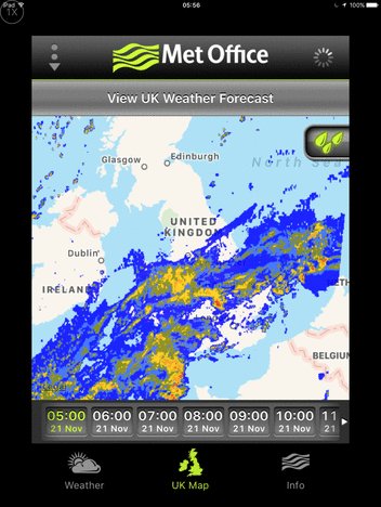
Wet weather is expected to sweep across the South West and move north, causing damage and disruption as it falls on already saturated ground.
Motorists are being warned not to drive through flood water and residents in at-risk areas have been advised to contact their local councils for sandbags to protect their homes.
The Environment Agency said rivers have been cleared to make sure water can flow freely.
Alison Baptiste, national flood duty manager at the Environment Agency, said: "Large parts of southern England have already experienced the impacts of Storm Angus this weekend.
"With more heavy rain on its way, people in the North and South West need to be prepared for the risk of flooding.
"Environment Agency teams have been out working through the night and we are now preparing for further flooding as rain continues over the next couple of days.
"People should remember not to drive through flood water and be aware travel may be disrupted.
"Environment Agency teams will clear blockages in rivers, continue to issue flood warnings and may operate flood gates and sea defences."
Storm Angus, the first named storm of the winter season, wreaked havoc on land and sea yesterday with hurricane strength gusts of 106mph.
It caused power cuts for more than 2,000 homes in the South West before the storm moved off into the North Sea.
Eleven crew members had to be rescued from a cargo ship after it crashed into a stone barge off the coast of Dover and began taking on water.
The other 12 remained on board as they worked alongside the Coastguard to bring the ship into port.
Fire crews in Devon spent Sunday pumping out flooded properties and roads, and warned many of those same areas are due to be hit by wet weather again.
Devon and Somerset Fire and Rescue Service station manager Martin Bayet advised people to take precautions and call 999 "if they are concerned for their safety".
He said: "There is likely to be a lot of surface water on country roads, particularly around Braunton, so motorists should be wary of the possibility of flooded roads, take notice of road closure signs and not attempt to drive through floodwater."
Part of Folkestone harbour was clsoed after high winds brought down a scaffolding staircase, and the sea wall at Swanage was badly damaged by the storm.
Wind speeds of up to 50mph are expected on Monday and the persistent downpours in the South West early on in the day are likely to be followed by thundery showers, the Met Office warned.
The Met Office said "On Monday a further broad area of heavy, persistent rain will extend northwards across South West England and Wales.
"The heaviest rain is expected to reach South West England in the early hours of Monday and to reach north Wales by around the middle of the day.
"Although the more persistent rain should clear from South West England into the afternoon, heavy and possibly thundery showers are likely to follow.
"Strong north-easterly winds will also develop for a time giving gusts of 50mph.
"Please be aware of the possibility of localised flooding and disruption to transport."


Post a Comment